A multitude of real world resources benefit from geographic data, many of which are already represented in IIIF digital collections. New and old maps, travel journals, newspapers, manuscripts, poems and diaries are just a subset of cultural heritage artifacts that have geographic characteristics. These traits bring human context to the material and offer a recognizable, comfortable setting for discovering connections between disparate resources.
Use Case
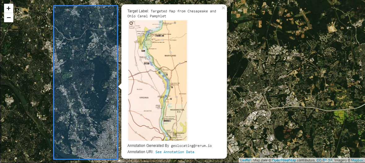
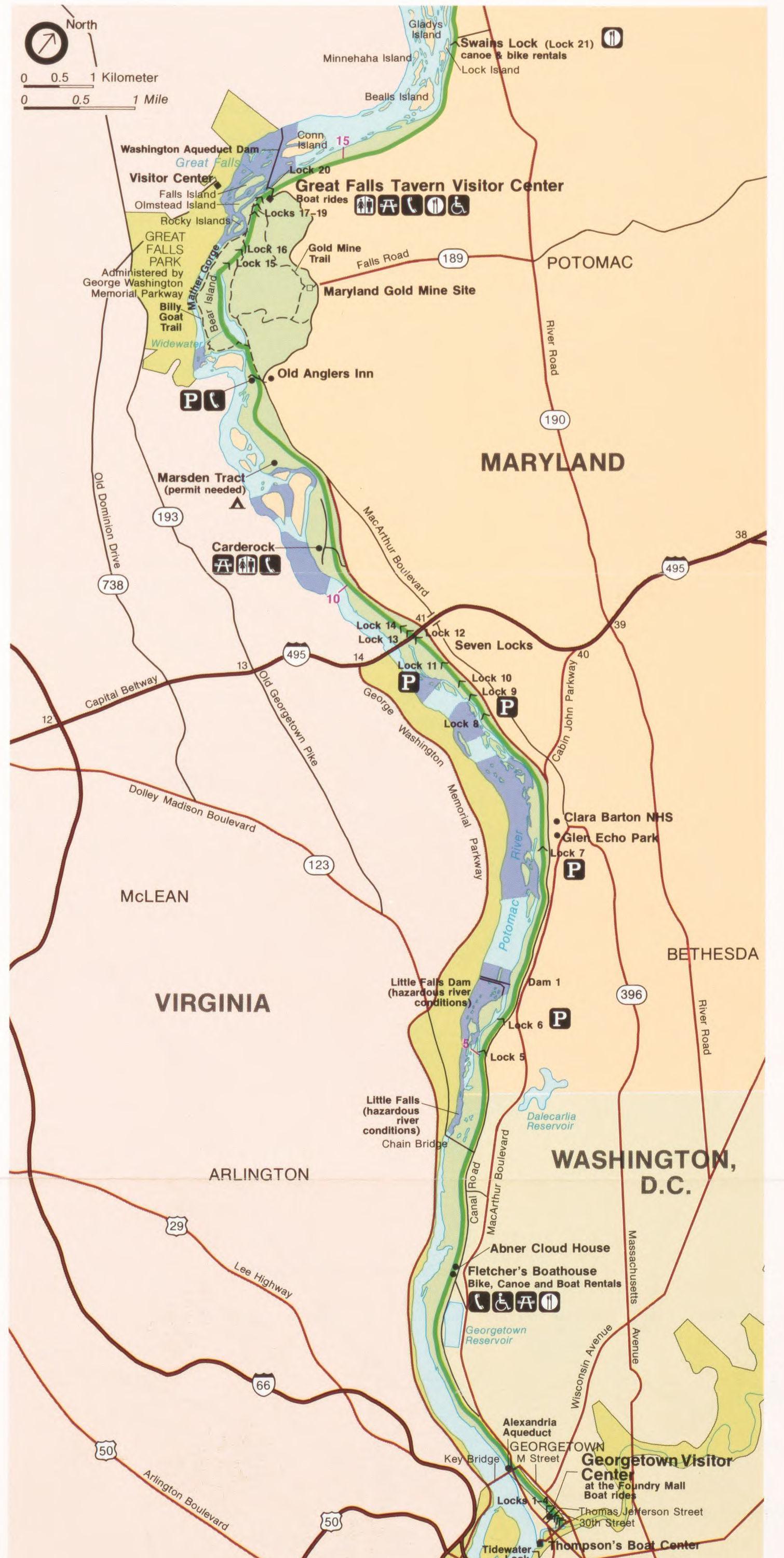
A Canvas has a region of interest that contains a map. You would like to associate this map with geographic coordinates for use in web mapping clients like Leaflet and OpenLayers. This could mean simply showing a non-interactive shape on a web map, but often more data from the resource is displayed in connection with the shape as a result of available functionality. The example below shows a pop-up that appears upon clicking the shape. The pop-up includes the targeted map as well as other metadata from the resource.

Implementation Notes
The third party GeoJSON-LD context is included in addition to the IIIF Presentation API 3.0 context. The GeoJSON-LD context supplies the vocabulary terms for the Annotation bodies since the IIIF Presentation API 3.0 context does not describe those terms. When there are multiple contexts, the @context property can be an array which is processed as a set. Typically order does not matter for a set. However, when the IIIF context is used in these arrays it must be the last item in the set.
The GeoJSON properties object is generic and can be nearly anything. It is used to pass metadata along with the geocoordinates. This has implications on clients and parsers that must discern what data to use. For example, if the targeted resource had a label property and the properties object has a label property, the consuming interface must make a choice on which to prioritize for presentation purposes. In the image from the Use Case section, the “Label” uses the GeoJSON properties object’s label property (lines 69-75) instead of the label property from the Annotation or Canvas. This is because web mapping clients are designed to look for metadata in GeoJSON properties for display.
Note that geometry has more types besides Polygon.
Restrictions
Applications that strictly follow Linked Data practices will find that nested GeoJSON coordinate arrays are incompatible with the processing model of JSON-LD 1.0. The JSON-LD 1.1 processing model does not have this restriction. Be aware if you plan to serialize JSON-LD into other semantic data formats or markup languages such as RDF.
Example
The Manifest has one Canvas with one Image, and the Canvas has the same size dimensions as the Image. The Canvas has one Annotation Page with one Annotation targeting the region of interest where a map depiction appears using the #xywh Fragment Selector syntax. The Annotation body is GeoJSON-LD, which is supported by a number of open source mapping systems. A client can parse the Annotation from the Canvas and pass the Annotation body into a web map resulting in rendered geometric shapes on a world map. Often, data from the resource such as an image URL, label, or description is connected with those shapes via properties in GeoJSON. Since the image used is a IIIF Fixture following IIIF Image API 3.0, you can see the targeted fragment by supplying the values used in the #xywh selector to the image URL.
JSON-LD | View in Annona | View in Theseus
Related Recipes
- [Fragment Selectors][0020]
- Tagging Annotation
Click Image to Close